AI for Agriculture
Why AI for Agriculture
- An agricultural workflow mapped around fields, crops and seasonal decisions
- Crop health monitoring using the imagery already available to your operation
- Yield forecasts validated against your historical and current-season data
- Irrigation and input recommendations informed by actual field conditions
- A monitored release that works with your connectivity and operational routines
Agricultural decisions — when to plant, how much to irrigate, when to harvest — carry real financial risk and often rely on experience alone.
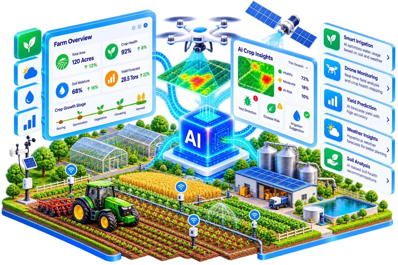
DashCloud builds AI for agricultural operations that adds data to that judgment: monitoring crop health from imagery, forecasting yield, and helping plan resource use more precisely, without replacing the grower's own expertise.
Inside AI for Agriculture
Crop monitoring
Using imagery (drone, satellite or ground-level) to spot crop stress or disease earlier than a visual walkthrough would catch.
- →Stress and disease patterns surfaced from imagery
- →Drone, satellite or ground-level sources supported
- →Field teams can review and confirm every signal
OUTPUT Crop health monitoring
Yield prediction
Forecasting yield based on historical and current-season data, to support planning decisions.
- →Seasonal yield estimates updated as evidence changes
- →Historical and current-season data combined
- →Planning teams see confidence and key drivers
OUTPUT Yield prediction
Resource-planning automation
Helping plan irrigation and input use based on field conditions rather than a fixed schedule.
- →Irrigation timing based on field conditions
- →Inputs prioritized where they are most needed
- →Recommendations remain adjustable by the grower
OUTPUT Resource planning
Turn field signals into timely action
Farm operators
Catch crop issues earlier with imagery-based monitoring instead of field walks alone.
Agribusiness planners
Use data-grounded yield forecasts for procurement, staffing and commercial planning.
Resource managers
Plan irrigation and inputs around actual field conditions and changing needs.
Field operations teams
Prioritize visits and interventions where the signals show the greatest need.
Agricultural advisors
Give growers clearer evidence to support recommendations across fields and seasons.
Growing organizations
Create a measured path from one useful field workflow to broader operational intelligence.
Built around real teams
Farm operators
Catch crop issues earlier with imagery-based monitoring instead of manual field walks alone.
- Which crop conditions matter most?
- What imagery is available?
- How should a grower review a signal?
Agribusiness planners
Get a data-grounded yield forecast for planning and procurement.
- Which historical and current data can we trust?
- How often should the forecast update?
- How should uncertainty shape planning?
Resource managers
Plan irrigation and inputs based on actual field conditions.
- Which resources are most constrained?
- Where is intervention most valuable?
- How much control should the grower retain?
From field data to better growing decisions
- 01
Understand
Map fields, crops, imagery, weather signals and the decisions where earlier information can improve yields or resource use.
Output: Field, crop and seasonal workflow map - 02
Scope
Choose the first crop, field or planning workflow and define how recommendations fit alongside the grower's experience.
Output: Prioritized agriculture use case and grower controls - 03
Build
Develop and validate the monitoring, forecast or planning workflow against representative imagery, seasons and field conditions.
Output: Validated monitoring, forecast or planning workflow - 04
Launch & improve
Release with grower feedback, seasonal monitoring and a process for improving predictions as crops, weather and operations change.
Output: Connected release with seasonal monitoring guidance
Improve one field, or plan across the operation
Focused agriculture pilot
Prove one crop monitoring, yield or resource-planning workflow using representative field data.
- ✓Imagery, weather and system review
- ✓One defined agricultural use case
- ✓Grower review and escalation design
- ✓Pilot findings and next steps
Agriculture AI workflow
Build and deploy a supported capability connected to the data and routines your operation already uses.
- ✓Monitoring, prediction or resource planning
- ✓Farm-system and data integration
- ✓Monitoring and grower controls
- ✓Launch support and documentation
Continuous field improvement
Keep models and recommendations aligned as seasons, crops, weather and field conditions change.
- ✓Seasonal performance reviews
- ✓New crops, fields or imagery sources
- ✓Model and workflow improvements
- ✓Ongoing technical support
Everything you need to know
Still have questions?
Can't find what you're looking for? Talk to our team and we'll point you in the right direction.
Contact usDrone, satellite or ground-level imagery can all work depending on your operation — we assess what's available and practical during scoping.
It depends on the quality and history of your data — we validate against your own past seasons before you rely on it for planning.
No — for remote areas we can run models on local edge hardware and sync when connectivity is available (see AIoT & Edge AI).